Need product customization?
We can customize PROTEUS to better suit your requirements
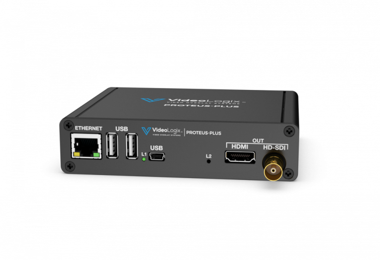
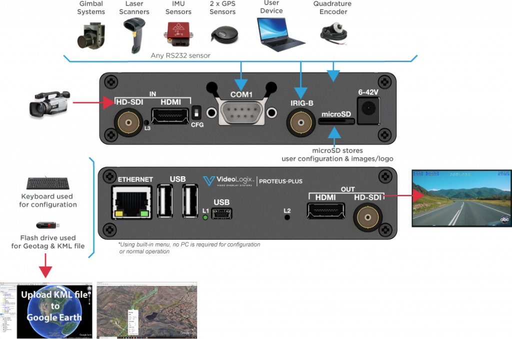
PROTEUS-PLUS includes all the features of PROTEUS-ESSENTIAL and the ability to create geotag media.
Geotagging is the process of syncing geographical data such as latitude, longitude, time, date, video time code (VTC), altitude, bearing, gyroscope pitch, roll & yaw, etc. to video. The process also produces a geotagged media (KML file) that is synchronized to video and can be viewed in Google Earth to see the exact locations where videos were taken.
To Download Our Brochure & Manuals, Click Here.
| General Features: |
|---|
| Full High Definition Video Overlay |
| Stand-alone operation i.e. no PC required |
| Simple user interface for configuring screen via USB keyboard |
| Overlay data from any GPS modem ($GPRMC, $GPGGA, $PTSAG, etc.) |
| Overlay data from NMEA 0183 sensors ($GPWPL, $GPGSV, $GPGGL, $SDDPT, $SDDBT, $WIMTW, $WIMWV, $VNINS, $VNIMU, $VNYPR, $PTNTHPR, $HCHDG, $HCHDT, etc.) |
| Overlay data from NMEA 2000 sensors (PGN 129029, 129025, 128259, 130323, 128267, etc.) |
| Overlay values from CSV sentences received via RS232, USB, Ethernet |
| Overlay texts such as user titles, time, date, latitude, longitude, etc. |
| Jam Sync Timecode with GPS, IRIG, RTC |
| Overlay PNG & JPG images |
| Superimpose composite (NTSC/PAL) video input over HD video input (PIP) |
| Generate KML file with multiple user defined place markers |
| Built-in Compass and Tilt (Pitch & Roll) sensors |
| User configurable fonts |
| Over 30 drawing commands through RS232, Ethernet, USB |
| Battery backed up real time clock (RTC) |
| Per pixel alpha blending |
| 1920 x 1080 OSD overlay resolution |
| Video: |
| HD-SDI input |
| HD-SDI output |
| HDMI input |
| HDMI output |
| Composite input (Viewable only as PIP over HD video input) |
| 1080i @ 50, 59.94, 60 Hz |
| 720p @ 50, 59.94, 60 Hz |
| 1080p @ 23.98, 24, 25, 29.97, 30 Hz |
| 480i (NTSC), 576i (PAL) |
| Fast video input to output delay i.e. 0.5 μs |
| Communication ports: |
| 2 x RS232 |
| 1 x CAN |
| 1 x USB2.0 Device |
| 2 x USB2.0 HOST |
| 1 x Ethernet 10/100 (Static or DHCP IPv4 addressing) |
| 1 x IRIG-B |
| Additional features: |
| Analog Inputs: Convert analog inputs to speed, depth, pressure… 2 |
| Quadrature Inputs: Convert count to distance, speed… |
| Supported Devices: GD Cineflex, Bar code scanners, VectorNav GPS/INS, Smartmicro radar |
| Apps: XY Measurements, Reticle, Rov situation awareness, Aerial situation awareness, Count up/down timer |
| Graphics Widgets: Slider, Compass |
| Generate KML for Google Earth: Geotag, Georeference |
| Design + Dimensions: |
| Box Dimensions (mm) 125 x 106 x 30 |
| Weight (1lb) |
| Power (6-42VDC, 4W) |
| 2-year warranty |
| Operating Temperature Range: 0-65°C |
2 Maximum input range: 3.3V